Grand Bay is part of the NERRS Sentinel Site Program, which was designed to understand long-term trends and short-term variation in marsh ecosystems.
The specific goals of the Grand Bay NERR (GNDNERR)’s Sentinel Site Program are to:
Determine rates of marsh elevation change and accretion,
Evaluate the effects of changing water levels and tidal dynamics on the composition and distribution of marsh vegetation,
Quantify change in GNDNERR habitats, and
Quantify shoreline erosion rates.
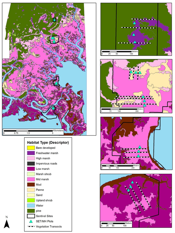
The infrastructure to accomplish these goals includes a continuously operating reference system (CORS) station, System Wide Monitoring Program (SWMP) water quality monitoring stations, a temporary tide gauge, surface elevation tables (SETs), marker horizon (MH) plots, vegetation transects, shoreline erosion monitoring sites, and a meteorological (MET) station. The SET/MH plots and vegetation transects are arranged along an elevation gradient that extends from open water at its southernmost extent, through low, mid, and high marsh and into a slash pine (Pinus elliottii) flatwood at its northern extent.
Elevation Monitoring
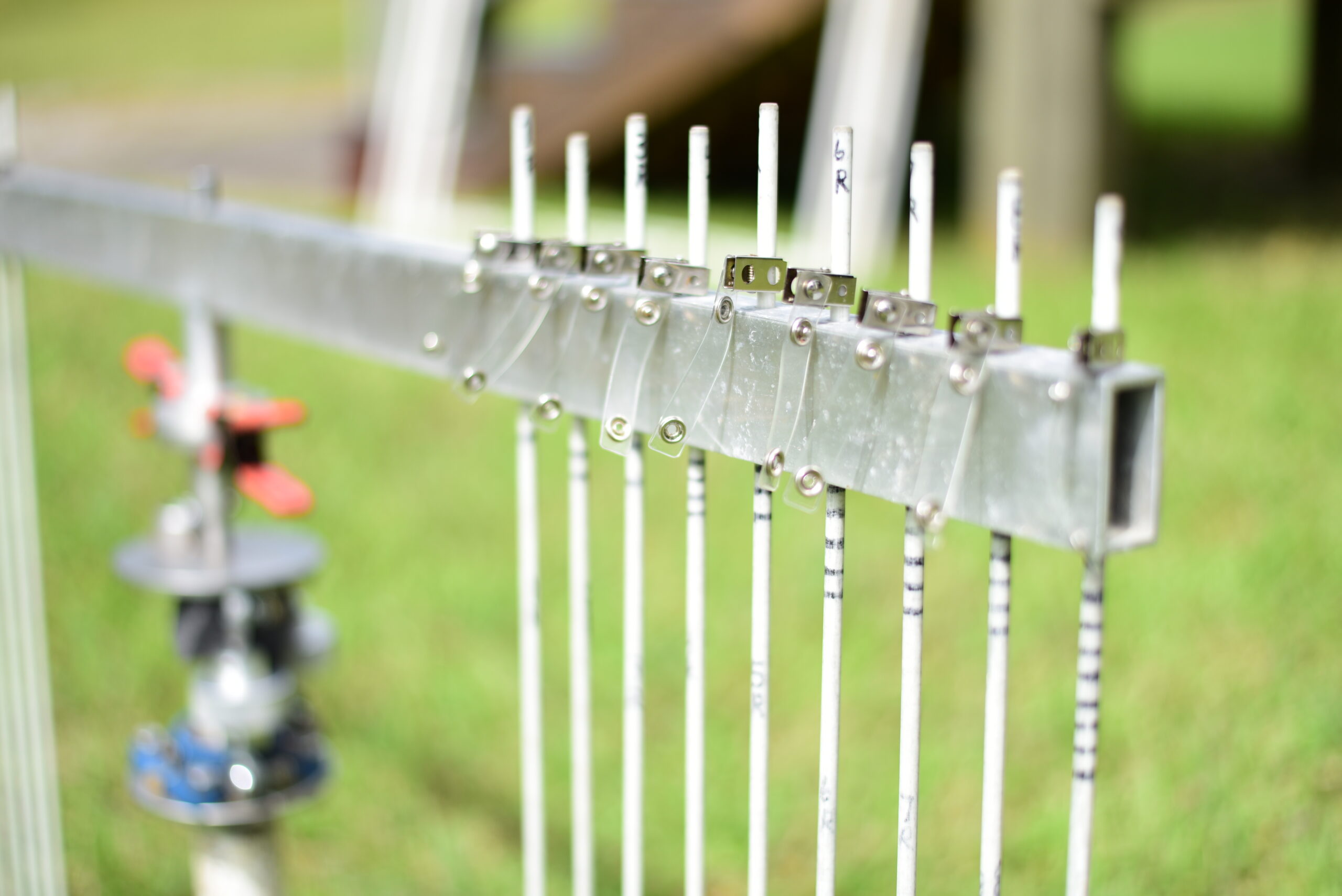
The surface elevation table (SET)
We use SETs and MH to measure fine-scale changes in marsh elevation at select areas within each marsh zone.To measure broad-scale changes in elevation, we create digital elevation models (DEMs) from real-time kinematic global positioning system (RTK-GPS) data collected across each marsh zone. For our data to have a connection to known elevation benchmarks, we also conduct GPS occupations and geodetic leveling. This allows us to understand and interpret changes in marsh elevation measured with our SETs and water levels measured with our SWMP stations. Quantifying change in marsh elevation helps us to understand the trajectory of each marsh zone, which can inform marsh conservation within the reserve and beyond.
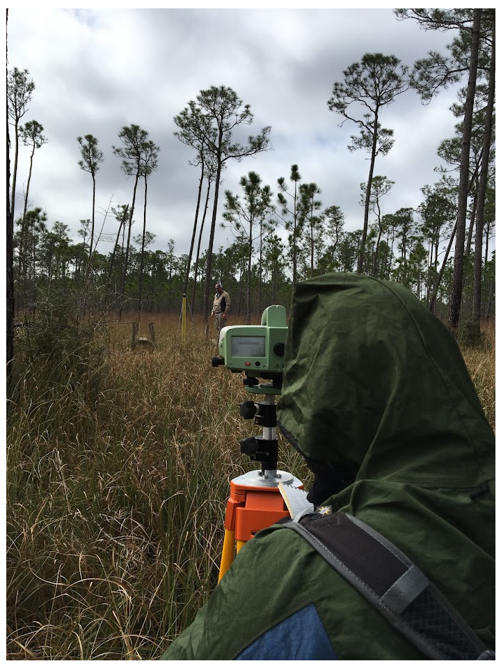
GNDNERR staff conducting geodetic leveling near the SETs. In the foreground is the Sprinter level on loan from the NERRS
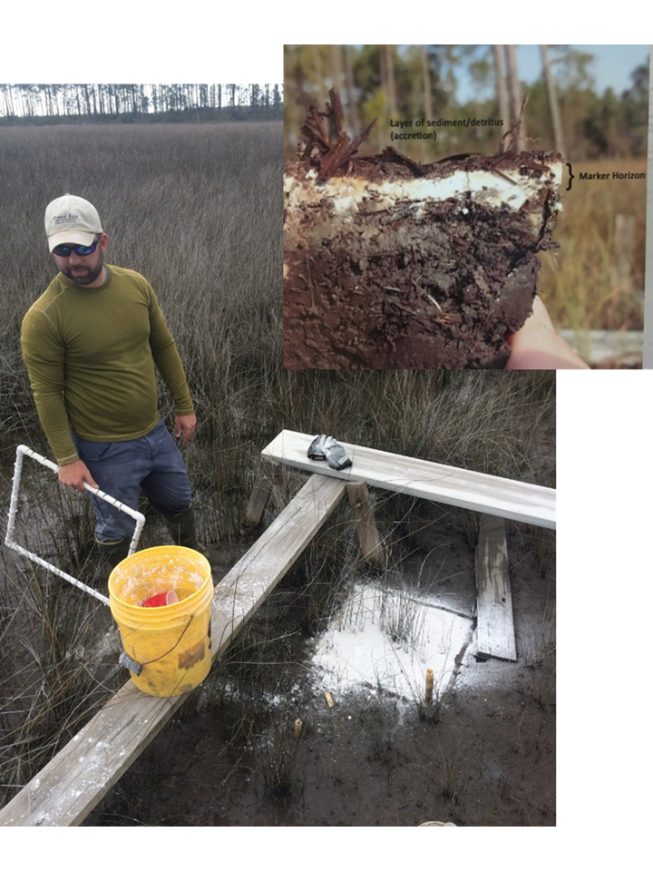
Mike and his beloved marker horizons (feldspar just re-laid). The inset photo shows what a core looks like where we take our marker horizon measurements.
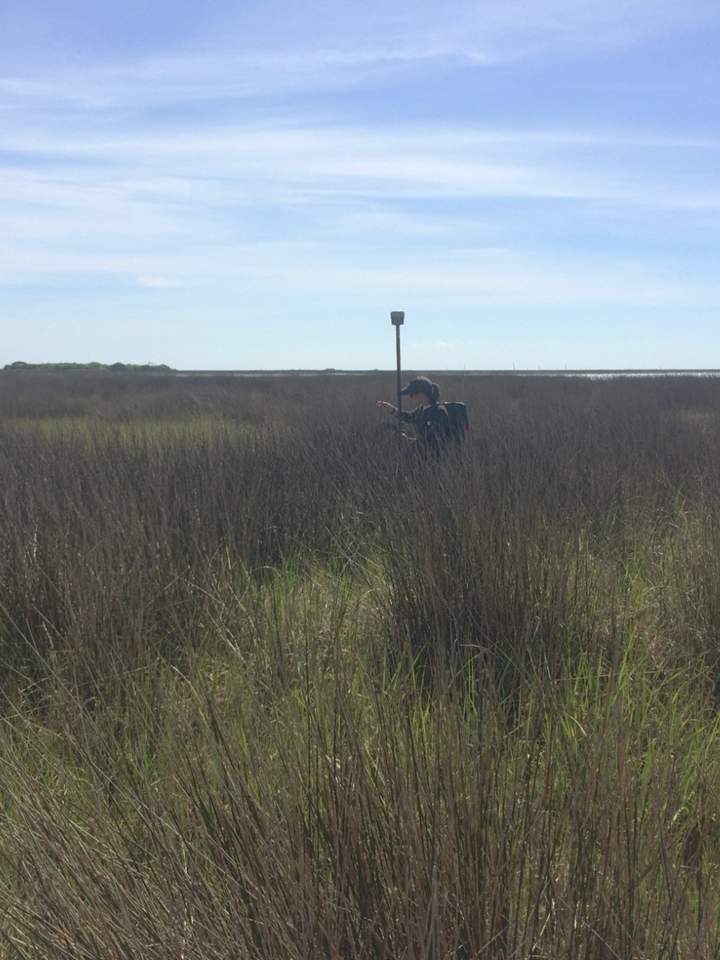
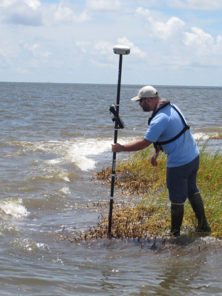
Caitlin using the real-time-kinematic (RTK) global positioning system (GPS) to measure precise elevations that are used to create digital elevation models (DEMs) for the sentinel sites.
Vegetation Monitoring
Click the image to enlarge.
We also monitor vegetation communities across the different marsh zones in response to changes in marsh elevation and tidal inundation. To do this we have established permanent transects and monitoring plots within each marsh zone where we measure biennial percent cover and stem density by species. We analyze this data periodically to quantify changes in plant communities. This information combined with long-term trends in elevation and accretion give us a more complete understanding of marsh response to changing sea level, which informs marsh conservation and restoration.
Sentinel sites along the coastal transition at Grand Bay. Shown at each site are the surface elevation tables (SETs) and vegetation transects. Also shown are the habitat types at each site from our habitat mapping efforts we conduct as part of the NERRS.
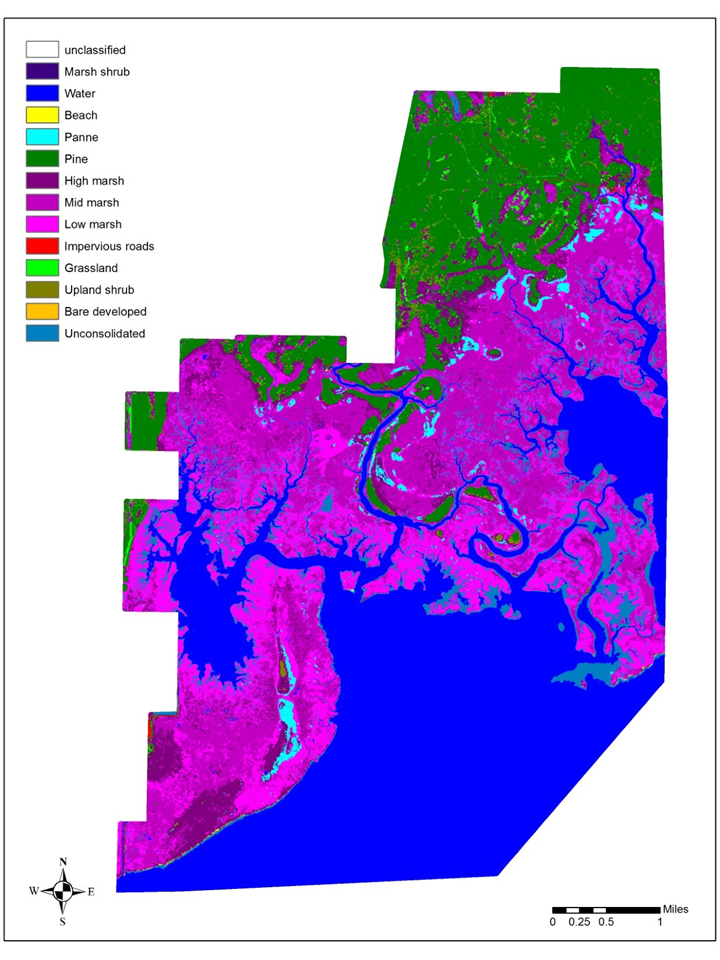
Habitat Mapping
Click the map to enlarge.
We also map all habitats in the reserve every 10 years under the guidance of the NERRS Habitat Mapping and Change Program. This program was designed to map decadal habitat change for all the reserves in the system, but is also useful for determining the acreage of reserve habitats, selecting sites for research, and selecting areas for us to focus conservation and restoration activities.
Shoreline Erosion
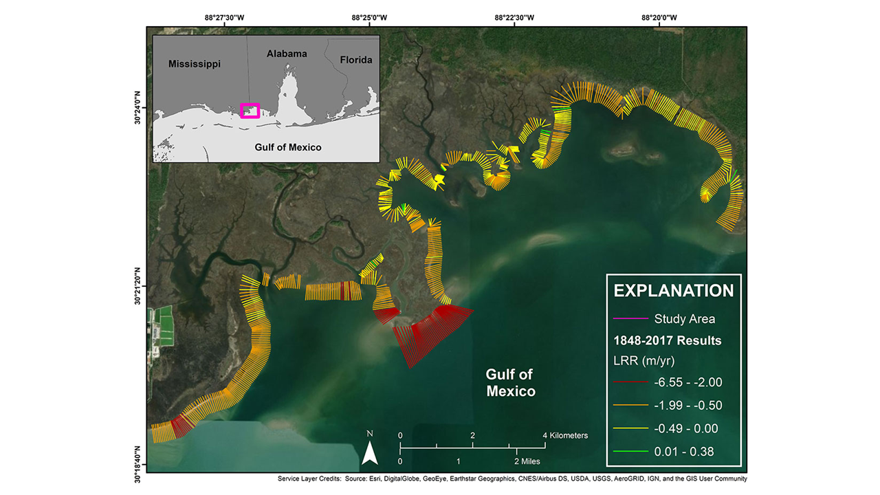
The Stewardship Team monitors shoreline erosion at 11 locations throughout the reserve with a real-time kinematic global positioning system (RTK-GPS). This data has been used by our partners at the United States Geological Survey to estimate marsh platform erosion across the reserves’ seaward shorelines. Erosion rates are as high as 6.5 meters per year in some areas. This is a high rate of erosion, but it is important to keep in mind that the Grand Bay Estuary is a retrograding delta. Grand Bay’s natal river ceased flowing into the estuary several thousand years ago, so Grand Bay no longer receives riverine freshwater and sediment inputs.
Mike Archer conducting shoreline erosion monitoring
Shoreline erosion rates as determined by our partners at USGS
Meet the Staff
Michael Archer is the Coastal Ecologist. He plays a major role in Sentinel Site Monitoring work at Grand Bay NERR.