
Grand Bay NERR Research Symposium
November 2, 2023
Welcome!
Welcome to Grand Bay NERR’s Research Symposium! We are excited to have you join us.
The Grand Bay NERR Research Symposium is an opportunity for researchers and managers to gather and learn about the ongoing work at Grand Bay NERR, whether that’s done by Grand Bay staff or external researchers. These presentations and discussions are opportunities to identify information gaps, brainstorm project ideas, and form new partnerships to tackle important research and management needs moving forward. Check out the presentation abstracts and list of attendees and their research interests! There is still time to register for the symposium as well.
Tentative Agenda
Symposium Objectives:
(1) Share significant research conducted in the Grand Bay estuary area;
(2) Provide results of research projects to researchers and natural resource managers; and
(3) Encourage collaboration among researchers conducting studies in the Grand Bay estuary.
7:45 – 9:00 am
Registration & Coffee
*8:00 – 8:50 am
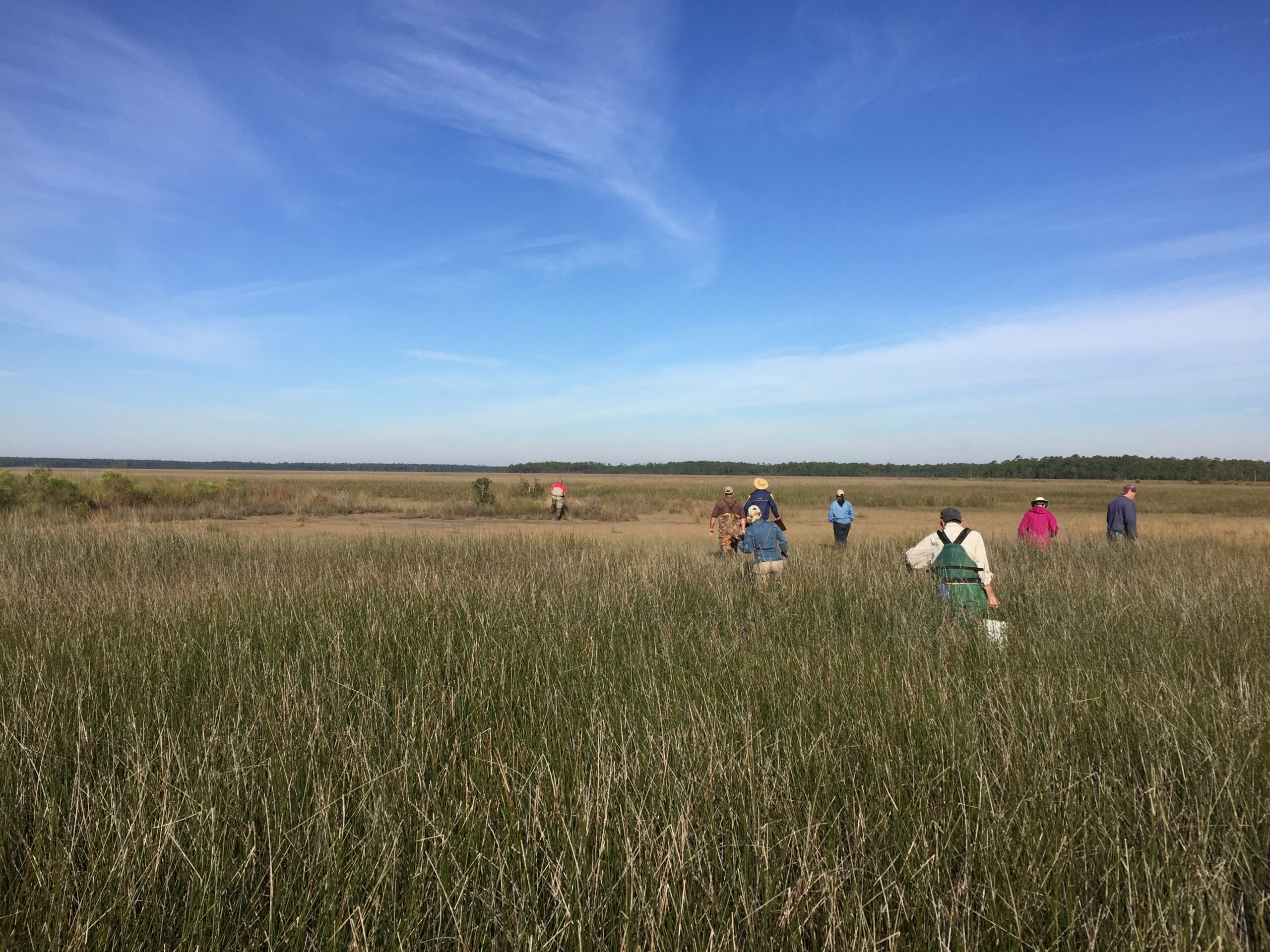
(*optional) Savanna Walk with Andrew Heaton, Emmett Carstens & Janet Wright
Depart 8:00, 8:15, 8:30
9:00 – 9:25 am
Welcome, Symposium Purpose, Introductions & Agenda Overview
9:25 – 9:40 am
The Road Map: Infrastructure revision to achieve transformational ecosystem restoration, economic prosperity, and community resilience in a Gulf Coast estuary (Ayesha Gray)
9:40 – 10:10 am
Morning presentations (upland habitats)
10:10 – 10:30 am
BREAK
10:30 -11:30 am
Morning presentations continued (upland habitats)
11:30 am – 12:45 pm
LUNCH
(*optional) Gopher Tortoise Burrow Excursion with Emmett Carstens & Andrew Heaton
Each excursion may take 20-30 min, transportation provided.
12:45 – 1:45 pm
Afternoon presentations (marsh & estuarine habitats)
1:45 – 2:00 pm
BREAK
2:00 – 3:00 pm
Afternoon presentations continued (marsh & estuarine habitats)
3:00 – 3:45 pm
POSTER SESSION
3:45 – 4:30 pm
Overview of Grand Bay NERR Research Efforts and Priorities
Science support for ecosystem function restoration and effectiveness monitoring (Facilitated Discussion)
4:30 – 4:45 pm
Symposium Wrap-up and Evaluations
4:45 – 6:30 pm
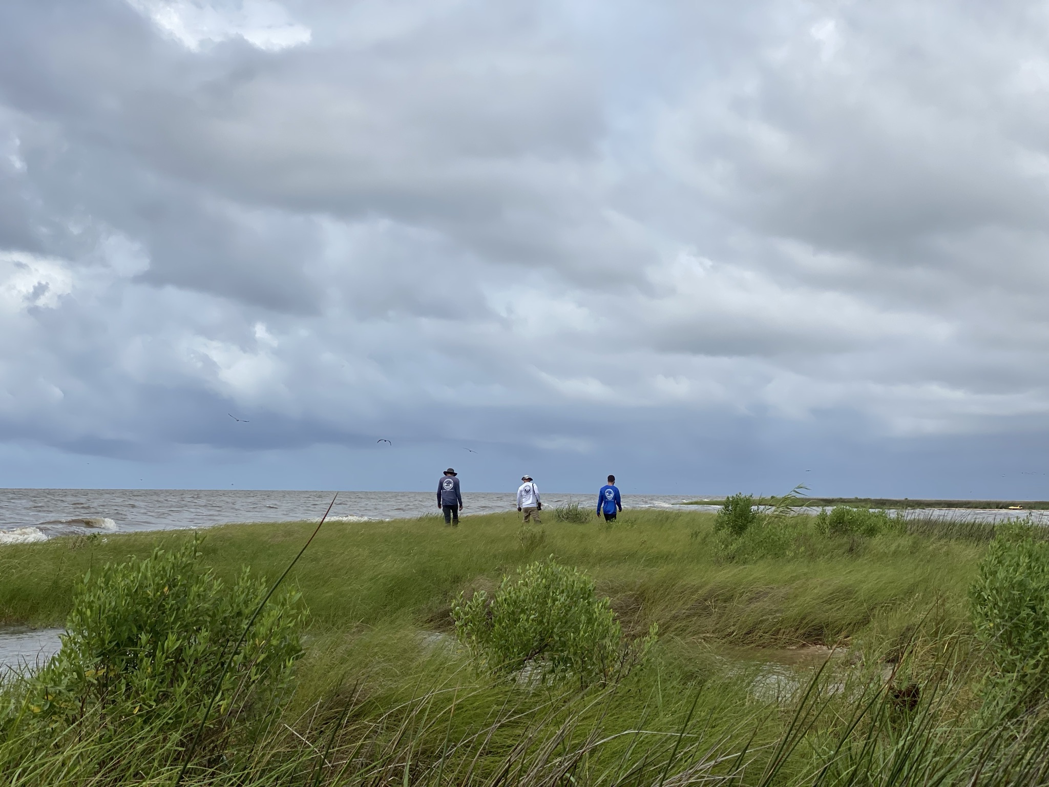
Sunset Bayou Excursion (including Social Dinner set up on pavilion from 5:30 – 6:30 pm)
Presentation Abstracts
Eric Sparks, Gill K, Pitchford J, Chenier K, Free A, Goff J, Cressman K, Posten M, Brunden E, Shelton M, Swanson K, Cunningham S, Garland J, Snyder C, Lamb M, Schauwecker T.
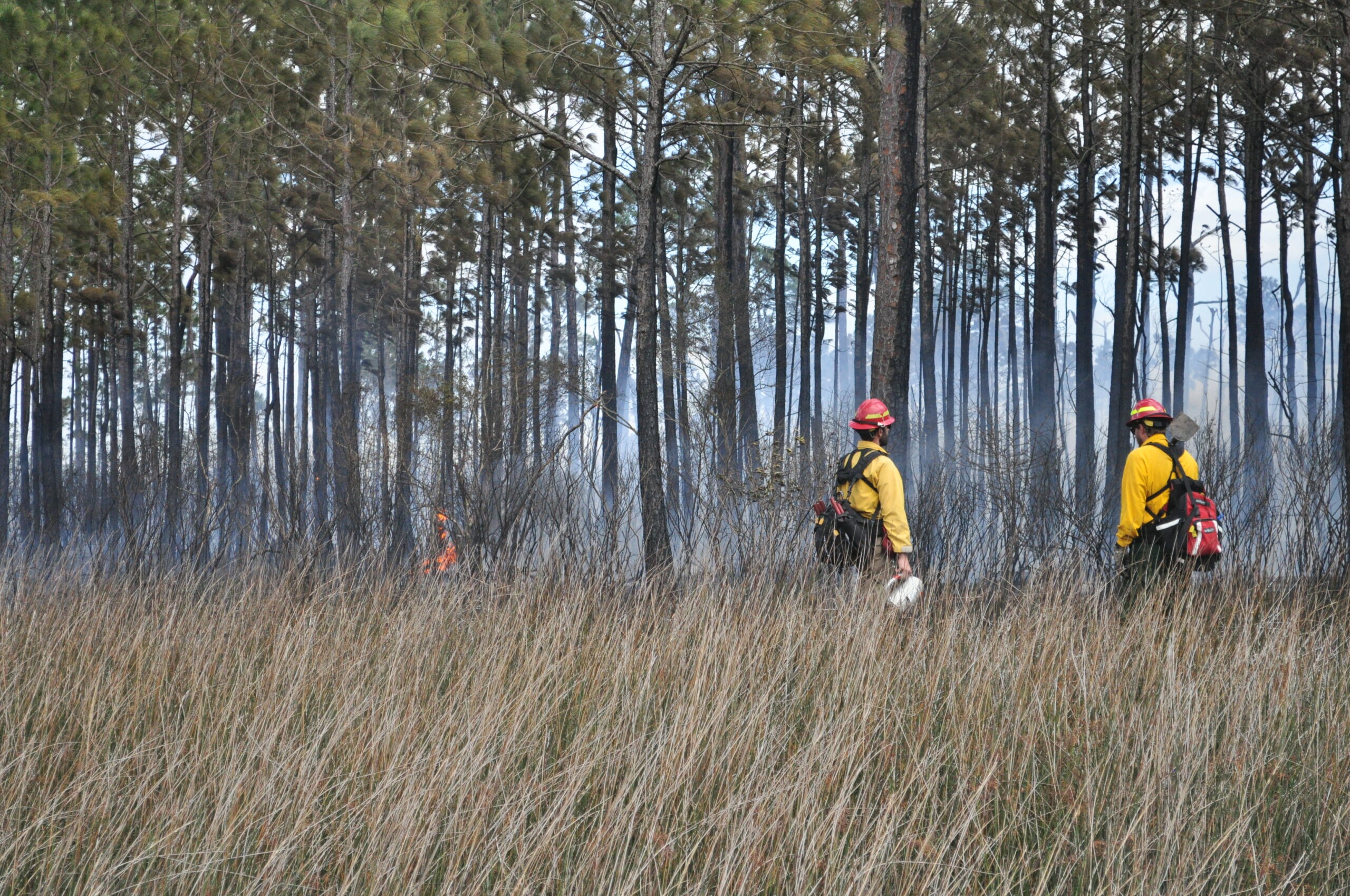
Along the Gulf of Mexico coast, natural resource managers struggle with managing coastal uplands due to front-end costs, prolonged maintenance, and habitat-specific ecological needs. Prescribed fire, mechanical removal of vegetation, and chemical treatments are commonly used to restore and maintain coastal uplands; however, there are challenges with the application of these tools (e.g., variable weather, urban development, etc.). A potentially less intrusive and a financially viable alternative is using livestock as a restoration and management tool. As part of a NOAA RESTORE Science Program Planning Grant, a survey was developed and distributed to natural resource managers with the goal of understanding the research needs, and logistical and environmental concerns related to using livestock for habitat management. Survey results show that >96% of respondents were interested in using livestock for habitat management, but <10% were aware of any information that could be used to inform grazing practices in coastal uplands. Generally small-sized cattle breeds (e.g., pineywoods) and goats were identified as the livestock with the most potential for environmental benefit and ease of containment. Items noted for further investigation included factors associated with implementation (e.g., which livestock type to use, grazing intensity, etc.), logistical considerations (e.g., fencing and rotational frequency), and the impacts of grazing on water quality, wildlife, vegetation, and livestock nutrition. Survey respondents overwhelmingly indicated that grazing would not be a standalone management practice and should be used in conjunction with other habitat management techniques (e.g., prescribed burns). This led the project team to develop two research objectives that need to be addressed regarding livestock grazing as a tool for coastal upland habitat management: 1) assessing the potential for livestock to spread and manage invasive and non-target species, and 2) determining the frequency and duration of livestock grazing needed to meet management goals across multiple habitat management scenarios.
Steve Brewer, Professor of Biology, University of Mississippi
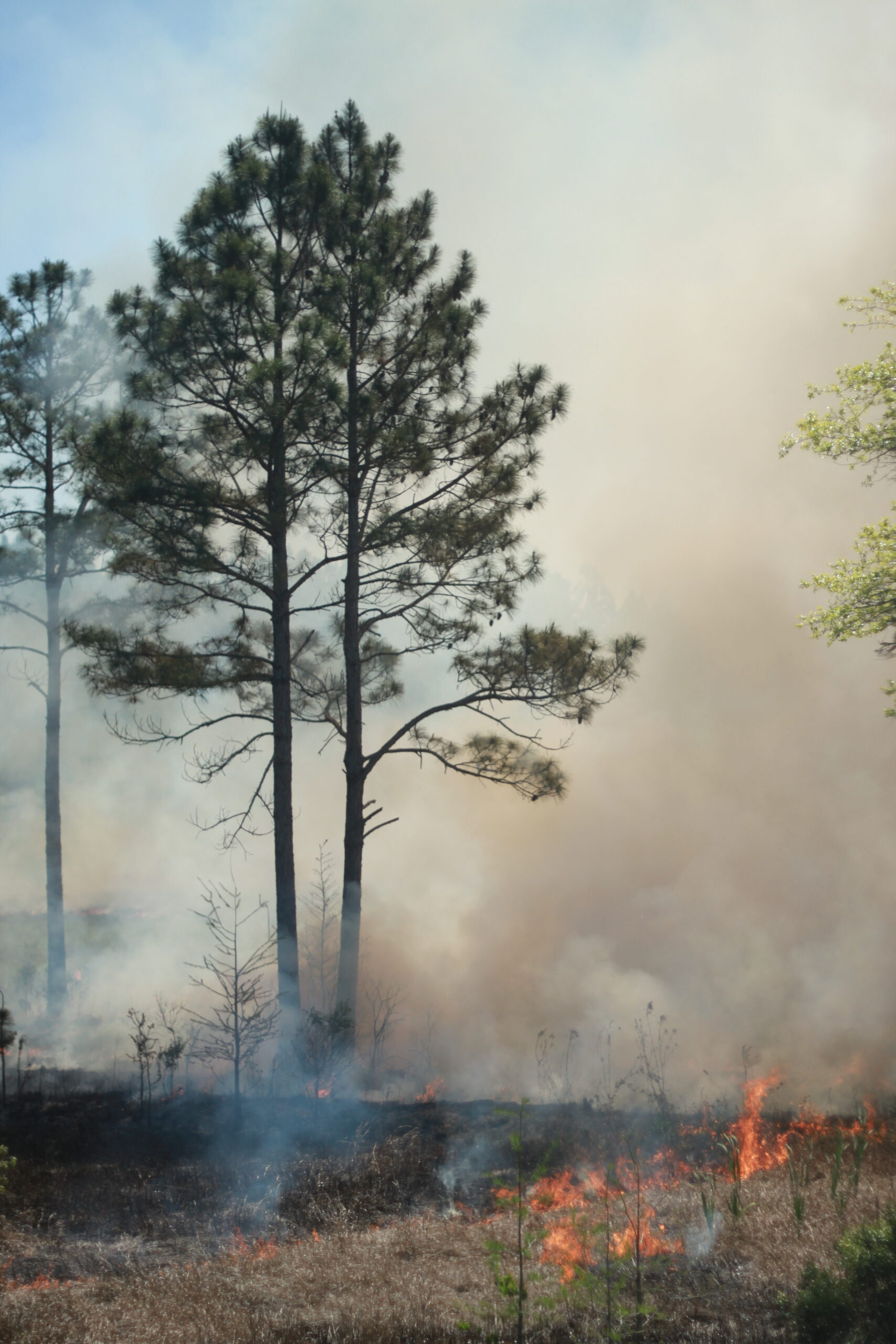
Pine savannas maintained by frequent fires contain among the most species-rich plant communities in the world. Precisely how fire maintains such high fine-scale diversity is poorly understood and not adequately explained by classical disturbance theory. I have previously shown that increases in species richness that occur in response to an increase in fire frequency can be simulated by removing surface litter and standing dead, without causing significant plant mortality. I thus created a simple patch model of fire-maintained plant species richness wherein community plant density increases with increasing fire frequency due to an increase in recruitment within litter-free patches. Increases in plant species richness are then simulated by randomly sampling individuals from a species pool. I validated the model with empirical data by determining whether observed changes in species composition that resulted from a reduction in simulated fire frequency in two wet pine savannas were different than expected by chance. They were not. The most abundant species in the annual simulated-fire treatment experienced the greatest losses in terms of density and frequency in response to a reduction in simulated fire frequency, consistent with a random expectation. However, these same species also exhibited traits that could explain the greatest increases in response to increased fire frequency (e.g., fire-stimulated emergence from a seed bank) and the greatest losses in response to a reduction in fire frequency (e.g., short life span). The observed changes in species composition thus may indicate a Narcissus Effect, wherein randomly generated assemblages of species are a reflection of non-random factors that produced differences in species abundances in the species pool (e.g., life history differences). I conclude that frequent fires maintain high plant species richness in wet pine savannas by increasing recruitment of most species, especially short-lived species, while eliminating few if any species.
Mandy Rigsby, Mississippi State University Coastal Research and Extension Center, Biloxi, MS 39532
Jonathan Pitchford, Grand Bay National Estuarine Research Reserve, Moss Point, MS 39562
Scott Rush, Mississippi State University, Starkville, MS 39532
Eric Sparks, Mississippi State University Coastal Research and Extension Center, Biloxi, MS 39532
Declining bat populations necessitates a need to understand how different land management techniques influence bat activity. This study assessed the influences of different coastal upland habitat management techniques, such as mulching, prescribed fire, and select cut, on forest bat activity within the Grand Bay National Wildlife Refuge and National Estuarine Research Reserve. Acoustic recorders were used to monitor bat activity and insect and vegetation surveys were used to assess influences on bat activity across different land management techniques. Results demonstrate that overall bat activity was similar across different land management techniques, however larger species adapted for open-space flying were shown to be less active within dense forest such as the select cut technique areas. Findings from this study suggest that various land management techniques can influence bat activity differently.
James Rigney, Certified Mississippi Master Naturalist, Jerome Goddard, PhD, Extension Professor of Medical Entomology, Mississippi State University
The Gulf Coast tick (Amblyomma maculatum) is the most abundant tick species in the wet pine savanna at the Grand Bay National Estuarine Research Reserve. As part of a Master Naturalist project, twice-monthly tick collections were conducted to determine the seasonal phenology of adult ticks from March 2022 through February 2023. Gulf Coast ticks began to emerge in July with the peak of activity in mid-July through early September, when over 100 Gulf Coast ticks were collected during each tick drag. Numbers began to decrease in late September, but a few specimens were collected as late as early November. Ad hoc collections conducted in August and September of 2023, after a prescribed burn in March 2023 and after an abnormally dry summer, yielded less than 15 percent of the number of ticks collected at the same times the year before indicating the possibility of large interannual variability.
Sofia Campuzano*, Department of Wildlife, Fisheries and Aquaculture, Mississippi State University, 75 B. S. Hood Rd, Mississippi State, MS 39762, sc2438@msstate.edu
Mark S. Woodrey, Mississippi State University Coastal Research and Extension Center, 1815 Popp’s Ferry Rd, Biloxi, MS 39532
Ray B. Iglay, Department of Wildlife, Fisheries and Aquaculture, Mississippi State University, 75 B. S. Hood Rd, Mississippi State, MS 39762
Jonathan Pitchford, Grand Bay National Estuarine Research Reserve, 6005 Bayou Heron Rd, Moss Point, MS 39562
Andrew Heaton, Grand Bay National Estuarine Research Reserve, 6005 Bayou Heron Rd, Moss Point, MS 39562
Emmett Carstens, Grand Bay National Estuarine Research Reserve, 6005 Bayou Heron Rd, Moss Point, MS 39562
Jacob Goff, Grand Bay National Estuarine Research Reserve, 6005 Bayou Heron Rd, Moss Point, MS 39562
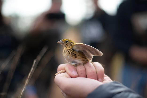
North American grassland bird populations have declined, due in part to the loss of suitable winter habitats, including the longleaf pine (Pinus palustris) savanna ecosystem, across the Southeastern United States. Longleaf pine savanna coverage has vastly declined across the Southeast region of the United States from approximately 23 million hectares prior to European colonization to less than 1.2 million hectares in most recent years due to habitat conversion, but perhaps most importantly, lack of fire. Several bird species of conservation concern are found during the winter in these longleaf pine savanna ecosystems along the Gulf of Mexico coast including Henslow’s Sparrows (Ammodramus henslowii). Our objectives in this study are to (1) document changes in bird communities associated with habitat management activities (i.e., mechanical clearing, prescribed fire, etc.) and (2) determine the presence/absence and density of winter grassland birds, with a primary focus on Henslow’s Sparrows, in relation to pine savanna restoration efforts. Initial avian surveys conducted December-March 2019-23, to establish baseline bird communities across sites to measure bird response to intensive land management actions indicate most of the restoration areas are dominated by species characteristics of shrub and forest. Preliminary data also showed a representative presence of grassland birds including Sedge Wren (Cistothoris stellaris) and Swamp Sparrow (Melospiza georgiana) and Henslow’s Sparrow. One site in particular, a regularly managed area using prescribed fire, had a significant number of winter grassland birds including 37 Henslow’s Sparrow, a Species of Greatest Conservation Need.
Emmett E. Carstens, Grand Bay National Estuarine Research Reserve, Moss Point, Mississippi
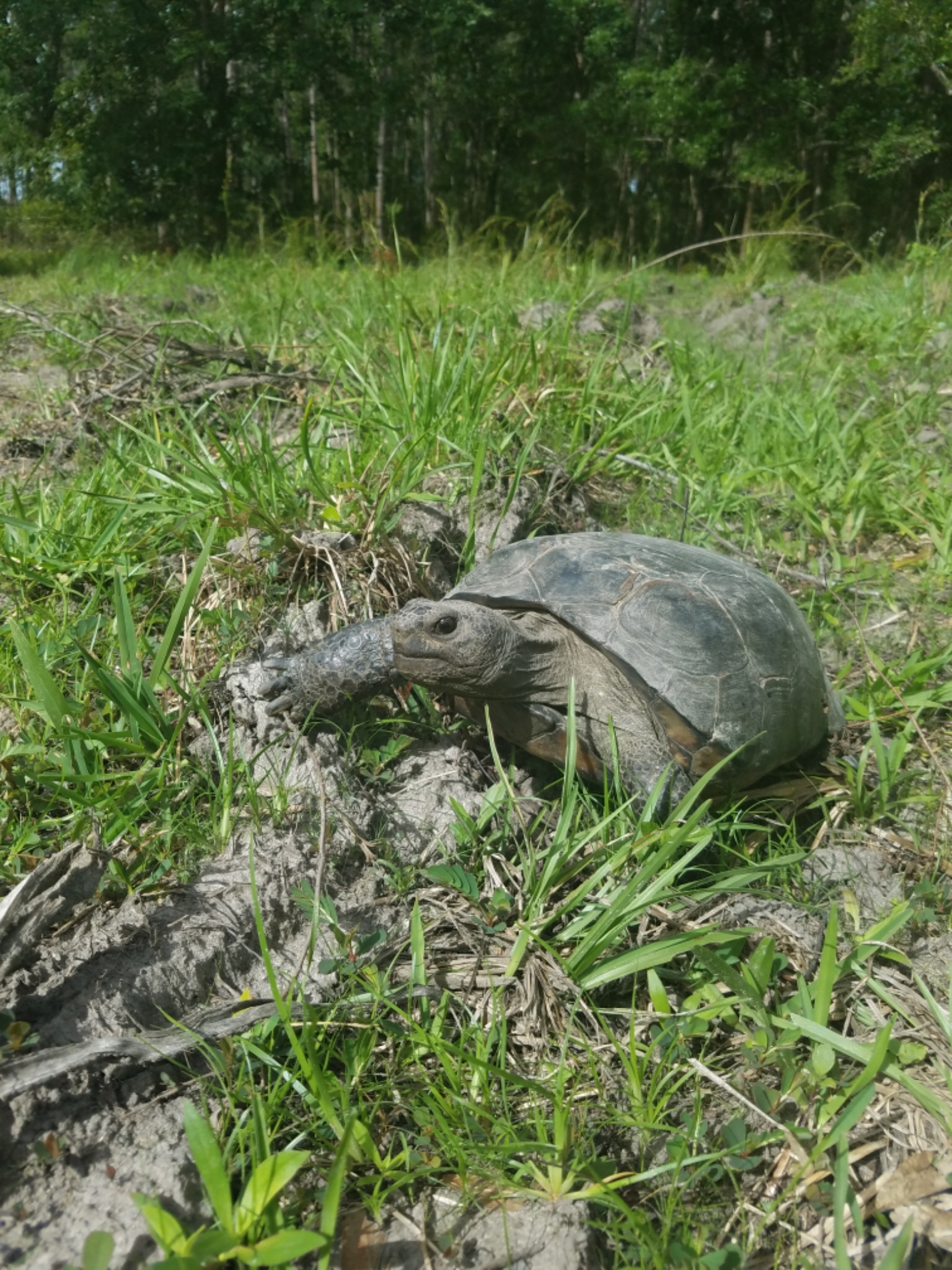
The Grand Bay National Estuarine Research Reserve (GNDNERR) has several completed and ongoing camera trapping projects. The passive nature of camera trapping limits the need for direct interaction with wildlife as necessary in live trapping. Camera trapping also eliminates the need to check traps daily, as the cameras can be left out for as long as the battery life and memory card allow. A year-long, NERR wide, marsh/ecotone camera project was completed in June 2023. This project had the goal of generating a broad-scale snapshot inventory of wildlife use of coastal wetlands and required standardized camera settings and placements. Following the conclusion of this project, two camera trapping projects began at the GNDNERR with the goals of 1) inventorying mammal species at the Reserve that may not be otherwise detected and 2) comparing vertebrate use of Nine-Banded Armadillo (Dasypus novemcinctus) and Gopher Tortoise (Gopherus polyphemus) burrows. Initial results from pilot camera trapping as burrows were located, show similarity in species assemblages between the two burrow types, as well as notable differences in visitation frequency between the burrows. Additional factors like elevation, substrate, light intensity, microhabitat of individual burrows, and historical land use may impact activity and visitation rates at burrow sites and will be included in the study. Comparing the vertebrate assemblages at the two burrow types will help determine the ecological role or niche of both species at GNDNERR and similar habitats.
Anthony Vedral, Coastal Research and Extension Center – Mississippi State University
Marine debris discarded in or transported onto marshes can negatively impact vegetation and shoreline stability. Such loss of habitat is of concern to coastal areas in the northern Gulf of Mexico due to ongoing habitat degradation and erosion as well as receding shorelines resulting from sea-level rise. This study aims to quantify the loss of vegetation due to the presence of debris for variable intervals of time as well as the recovery rates of vegetation with and without restoration efforts after removal of debris. Two common types of debris items (wire crab pots and dense plastic squares intended to mimic opaque debris) were placed on 48 plots of 0.4 m2 black needlerush (Juncus roemerianus) vegetation in the Grand Bay National Estuarine Research Reserve at shoreline and high marsh locations. Monitoring of vegetation density, leaf height, canopy coverage, elevation, and sediment grain size were conducted to assess changes in marsh dynamics. Following removal, half of the plots were re-planted while the rest were left to recover without intervention. Data analysis is ongoing, but preliminary results indicate varying impacts relative to debris location, duration of exposure, and debris type. Data from this project will provide useful spatial and temporal information for making critical decisions when prioritizing wetland cleanup sites and restoration efforts from ongoing litter accumulation and sudden debris spreading disturbances such as hurricanes.
Amanda Free, Kim Cressman, Philip Lee, Eric Sparks
Keywords: microbial source tracking, qPCR, fecal indicator bacteria, enterococcus
The Grand Bay National Estuarine Research Reserve (GNDNERR) has chronically elevated fecal coliform counts; however, the source of the contamination is unknown. Due to the poor understanding of the local fecal pollution sources, this area has not been opened to shellfish harvesting since 2007. According to past sanitary surveys, there has been a history of malfunctioning residential septic systems and inadequate wastewater treatment in the upper watershed. Feral hogs and birds are also abundant in the estuary and could be a potential contributor to elevated fecal coliform levels in this area. The GNDNERR is located on the northern Gulf of Mexico coastline which is known to receive some of the highest annual precipitation totals in the United States. The intense rainfall can lead to a large fecal load from upland sources into the estuary. To better understand the temporal and spatial variation of fecal coliforms in the GNDNERR and inform oyster reef management, monthly sampling will take place over the course of a year at six sites within the main watershed of the GNDNERR and two sites upstream in the bayous. Having the two sites upstream will allow for a better understanding of how rainfall affects fecal contamination throughout the estuary. Quantitative polymerase chain reaction (qPCR) will be used for microbial source tracking to identify levels of potential fecal sources from humans, feral hogs, and birds within the estuary as well as the concentrations of
enterococcus, a fecal indicator bacteria.
Jessica Woodall, University of Southern Mississippi
Seagrass beds support high biodiversity and animal abundance, serve as feeding grounds for a variety of animals, offer shelter from predation, and act as a nursery habitat for juveniles. The species composition of seagrass beds can impact their use as habitat by animals. Two common species of seagrass in the Gulf of Mexico are Ruppia maritima (widgeon grass) and Halodule wrightii (shoal grass). The shallow coastal waters of the Grand Bay National Estuarine Research Reserve (NERR) support both species, but the use of each seagrass as habitat by nekton is poorly understood, which limits management decision-making. Nekton communities were sampled in May, July, September, and November 2022 in the Grand Bay NERR within R. maritima and H. wrightii-dominated seagrass beds and unvegetated habitat. All nekton were collected, identified to species, weighed, and measured to quantify density, species richness, and species diversity within each habitat. Seagrass cores were also collected to quantify aboveground biomass, root to shoot ratio, and epiphyte density. Juveniles of several commercially fished nekton species including blue crabs (Callinectes sapidus), white shrimp (Penaeus setiferus), and brown shrimp (Penaeus aztecus) were collected, with higher densities and greater species diversity in seagrass beds compared to unvegetated bottom. R. maritima and H. wrightii were marginally different from each other in terms of habitat use by nekton. Percent cover of both species was the most important habitat feature influencing use by nekton, with greater cover hosting more nekton. These results reinforce the importance of seagrass within the Grand Bay NERR as essential habitat and can be used to inform management and long-term planning.
Presenting Author: Sarah Ramsden
Affiliation: Ph.D. student, University of South Alabama at Dauphin Island Sea Lab
Email: sramsden@disl.org
Co-authors: MA Albins1,2, MA Dance3, SP Powers1,2, R Baker1,2
Affiliations: 1University of South Alabama; 2Dauphin Island Sea Lab; 3Louisiana State University
The eroding shoreline of Point aux Pins Peninsula, off the coast of Bayou la Batre, Alabama, has been the subject of two major protection and restoration efforts. Manmade reefs constructed from loose oyster shell were installed along this shoreline in 2007. These reefs have largely eroded, and in 2020, a series of concrete wave attenuation pyramids were installed further offshore. We used fine-scale acoustic telemetry to track the movements and monitor the behavior of sportfish (Red Drum, Speckled Seatrout, Sheepshead) around these shoreline protection structures. We deployed an array of closely spaced acoustic receivers that can triangulate the positions of acoustically tagged fish with an accuracy on the order of 1-2m. Tracks of fish positions were sorted into three behaviors, based on the distance and turning angle between successive positions: (1) travelling, a straight path of long steps; (2) sheltering or ambushing, a tortuous path of short steps; and (3) foraging, a tortuous path of medium length steps. Surprisingly, given their highly eroded state and lack of topographic relief, the manmade oyster reefs were used for foraging by all three tracked species. These reefs had been more or less classified as “defunct”, and because they do not contribute to shoreline protection or oyster recruitment would have been marked for removal in some coastal states. However, in actuality, they are still serving as valuable habitat for economically and culturally important fish species.
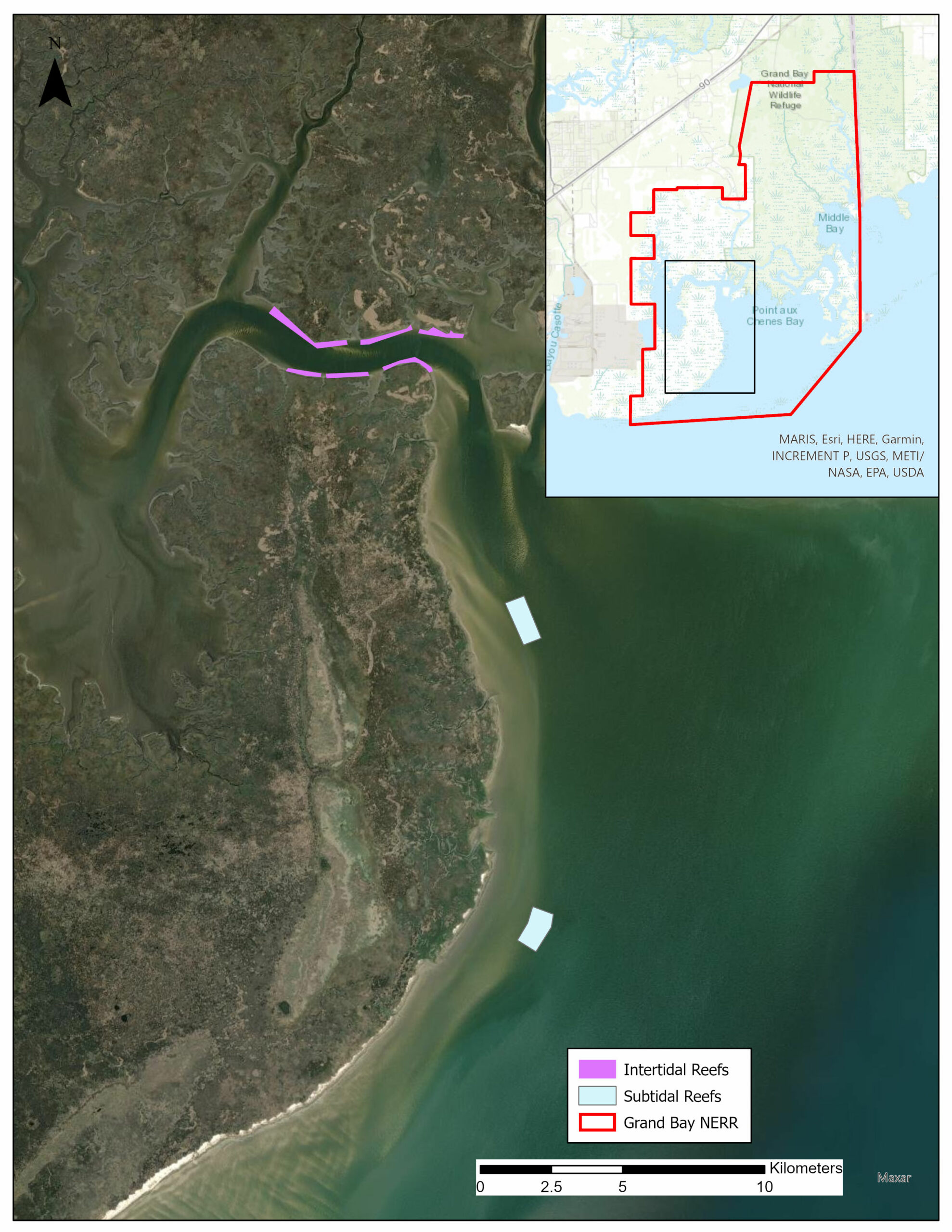
Michael J. Archer, Jonathan L. Pitchford, Michael Brochard, Cher Griffin
The Grand Bay estuary is a retrograding deltaic system along the northern Gulf of Mexico experiencing high rates of shoreline erosion, topping 2 m/yr in some locations. Total marsh extent at the Grand Bay National Estuarine Research Reserve is decreasing as exposed erosional marsh edge loss is exceeding upland-marsh migration. Sub- and intertidal artificial reefs were installed within the Reserve in early 2021 with the goals of decreasing shoreline retreat by reducing wave energy, and creating functional habitat. Using a Before-After-Control-Impact (BACI) experimental design, resident and transient fish assemblages were sampled pre- and post-reef construction every other month from January 2019 to March 2023 using a 750’ gill net at one intertidal reef and control site, and two subtidal reef and control sites. A total of 45 species and 8,203 fish were caught during the sampling period. Permutational Analysis of Variance (PERMANOVA) results determined that there were differences in the fish communities pre- and post-reef construction at subtidal habitats, but not intertidal habitats. Similarity of Percentages (SIMPER) results show that an increase in speckled trout (Cynoscion nebulosus) and Atlantic croaker (Micropogonias undulatus), and a decrease in Gulf menhaden (Brevoortia patronus) and spot (Leiostomus xanthurus) drove much of the change in the fish community at subtidal reef sites. There was also a sharp decline in the number of times no fish were caught at reef sites. Artificial reefs can hopefully be a valuable tool in conserving marsh extent as well as creating functional habitat. This project will be used to inform project managers about their impact on the local fish community in an estuary environment.
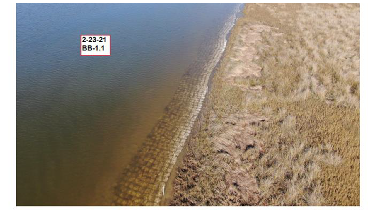
Matthew Virden, Mississippi State University
In the northern Gulf of Mexico, oysters and marshes have been critical components estuarine ecosystems, and provide myriad ecological and economic benefits. At the Grand Bay National Estuarine Research Reserve, there is a large-scale subtidal and intertidal living shoreline project that finished construction in July 2021. A suite of ecosystem functions and services are being evaluated at the intertidal and subtidal study sites, along with nearby control sites. Wave gauges are deployed on a rotational basis and replicated in front and behind reefs and at similar locations in control sites to evaluate the influence of reef placement on wave energy. To provide large-scale estimations of shoreline position and vegetation cover, quarterly unmanned aircraft system (UAS) flights are conducted. Continuous georeferenced maps are produced of the entire study area from the UAS flights. Fine-scale field measurements using an RTK for elevations and quadrat counts for fringing vegetation are being used to validate UAS maps. Oyster settlement is monitored using tile-based spat collectors deployed on both intertidal and subtidal reef areas as well as nearby controls. The impact on secondary productivity is being monitored using nekton settlement trays deployed at both reef and control sites. Evaluating the impact of restoration efforts will be accomplished using a variety of univariate and multivariate approaches across the range of metrics measures. Understanding this impact of oyster reef restoration on a wide range of ecosystem functions will better inform the planning and implementation of future restoration projects.
Andrew Heaton, Grand Bay NERR
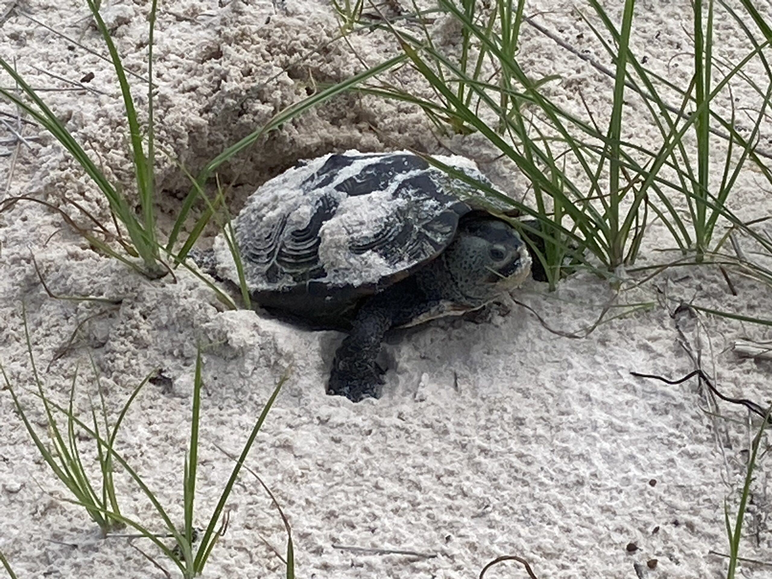
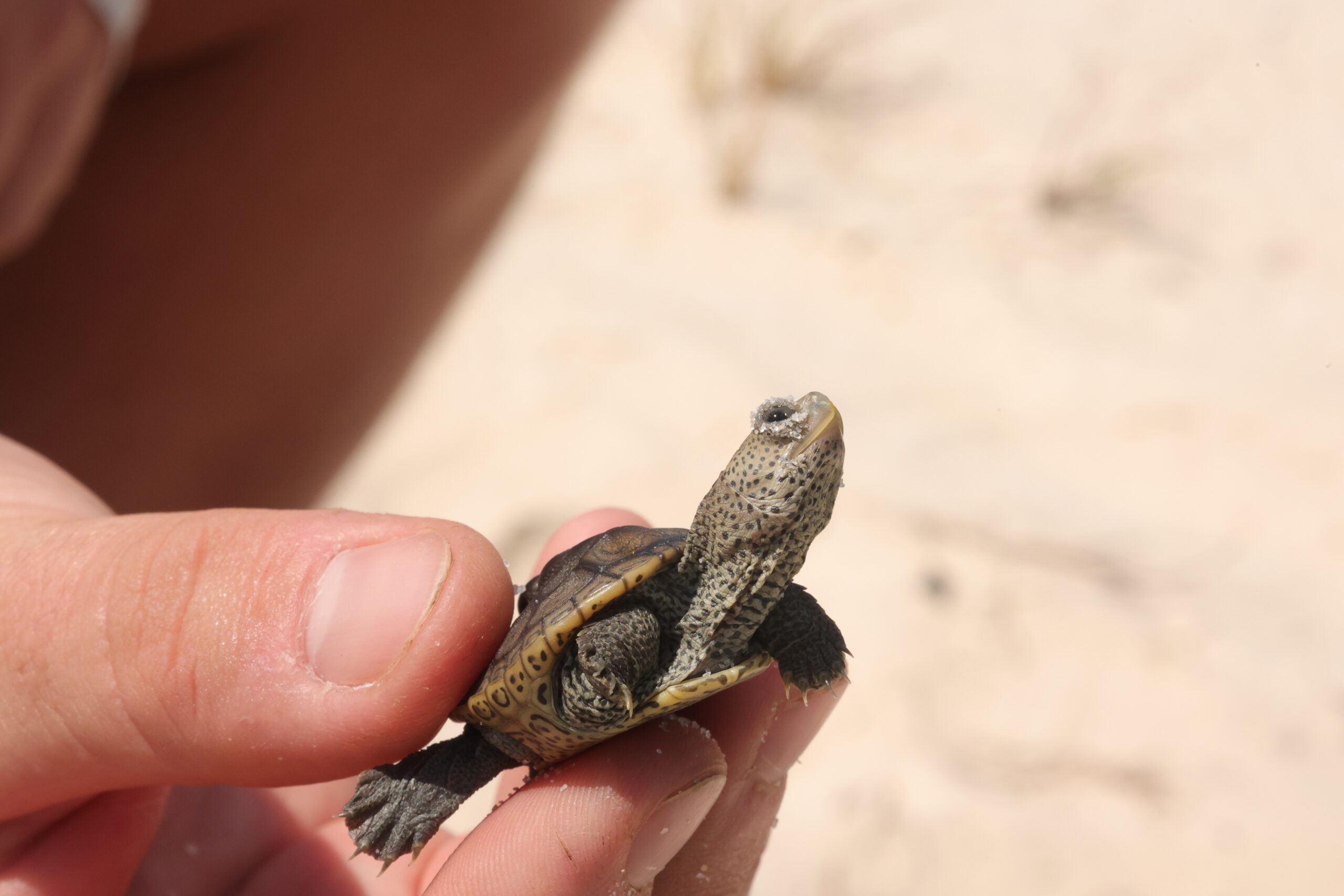
In the Grand Bay National Estuarine Research Reserve (GNDNERR), Mississippi Diamondback Terrapins (Malaclemys terrapin pileata) primarily nest at two locations, Point Aux Chenes and Grand Battures. The shorelines of these marsh beaches are retreating at rates of 0.50-1.99 and 2.0-6.55 meters per year, and Grand Battures has seen its available shoreline nesting habitat decrease by 38% from 2014 to 2021. Depredated nest monitoring efforts over the past two decades have also found the lowest number of nests at Grand Battures to date in 2021, with increased search effort. To determine what factors drive nest site selection at the GNDNERR, a survey of environmental characters of nesting sites occurred in 2022. Elevation and presence of Spartina patens, respectively, were the two factors found to drive nest site selection the most. Nests below the mean high water (MHW) level are typically not successful due to inundation. The local MHW is 0.33 m, and >90% of all nests were found at elevations >0.83 m, which supports this. Most nesting beach habitat in the GNDNERR is low elevation, and our monitoring has found nests to be grouped in small patches of higher elevation beach when not much is present at a site. Elevation and plant community should be considered when determining nesting habitat quality, and we believe the information from our monitoring can inform future restoration, management, and research of this species and its habitat.
AUTHORS: Iwo P. Gross* and Matthew E. Wolak
Department of Biological Sciences, Auburn University, Auburn, AL 36849, USA
*Corresponding author and speaker: Ph.D. Candidate, ipg0004@auburn.edu
In studies of sexually reproducing organisms, the paternal contribution to the population growth rate is often ignored on account of the assumption that males generally do not limit the reproductive success of female conspecifics. However, theoretical and empirical studies have shown how sexual conflict and skewed operational sex-ratios can shape mating systems and ultimately influence population extinction risk. Quantification of mating system dynamics should therefore be a priority when assessing the viability of depleted populations. Here we propose a study design which will produce the first estimates of the rate of multiple paternity—a key characteristic of mating systems—from a diamond-backed terrapin (Malaclemys terrapin pileata) meta-population along the Alabama-Mississippi coastline. Despite the cryptic nature of terrapin mating systems, the predictable nesting habits characteristic of all turtles provide us an opportunity to collect maternal and embryonic genetic material from emerged nests and thus infer parentage. Considering high rates of terrapin nest predation, however, we describe the development and validation of a method to extract DNA from depredated terrapin eggshells and their residues. We hope this non-invasive genetic sampling approach will provide useful information regarding mating system structure at key terrapin nesting beaches along the northern Gulf of Mexico.
Aaron Bland and Ronald Baker, Dauphin Island Sea Lab
Coastal restoration projects often provide hard substrate to be colonized by live oysters. When engineered structures develop into oyster reefs, the reefs may improve water and habitat quality, and improve shoreline protection. However, many structures fail to develop into oyster reefs due to various ecological forcings. We investigated potential factors that may prevent oyster reef development on living shoreline breakwaters in Portersville Bay, Alabama.
We deployed ceramic tiles at two living shoreline sites across a range of tidal elevations. Bare tiles were used to investigate rates of wild oyster settlement, and tiles seeded with live oyster spat were used to examine post settlement mortality. We observed very limited wild recruitment to date, and high rates of post settlement mortality. At one site, (Point aux Pins), overall mortality was greater but decreased at increasing tidal elevations. At the other site (Coffee Island), mortality was lowest at an intermediate tidal elevation. Notably, this potentially “optimal” elevation was higher than the crests of the nearby breakwater structures.
We found that oysters at living shoreline sites are likely limited by post settlement mortality, especially predation, and potentially by larval availability. Furthermore, the successful development of oysters on living shoreline structures may depend in part on the amount of intertidal refuge provided by the structure. These results may improve future oyster restoration by informing living shoreline siting and design.
Ania Brown, Jennifer Bloodgood, Brandi Kiel-Reese, Ruth H. Carmichael
Freshwater discharge conveys pollutants and pathogens to coastal waters, degrading water quality and threatening ecosystem and human health. Bottlenose dolphins (Tursiops truncatus) are common residents of bay, sound, and estuarine habitats, where overlap with human activities and impacts to the marine environment are greatest. Coastal northern Gulf of Mexico (nGOM) receives among the highest freshwater inputs among watersheds in the U.S. and supports resident bottlenose dolphin populations, providing a unique setting to study the effects of water quality and subsequent effects on dolphin health. In recent years (2020-2022), pathogens including the bacteria Erysipelothrix and the parasite Toxoplasma gondii have been documented in stranded bottlenose dolphins. In the case of Erysipelothrix, two dolphins died of acute sepsis following high freshwater influx. Erysipelothrix and T. gondii are ‘One Health’ pathogens of importance to animal, environmental, and human health that can be transported to aquatic environments through runoff and are associated with disease and mortality in many species. This ongoing study seeks to determine if seasonal freshwater discharge patterns and associated water quality changes (e.g., increased contaminants, microbial indicators, pathogens) relate to metrics of health (body condition, lesions, pathogens, hormone levels) in dolphins. As long-lived, mammalian apex predators, dolphins are potentially valuable analogs to assess human health risks. Hence, understanding relationships between water quality and dolphin health will necessarily help identify potential human health risks and support critical management of waters commonly used by marine mammals and people, especially under increasing anthropogenic land use and climate changes that will continue to impact water quality.
Emmett E. Carstens, Grand Bay National Estuarine Research Reserve, Moss Point, Mississippi
The Grand Bay National Estuarine Research Reserve (GNDNERR) Herbarium currently has 711 specimen records consisting of 458 species since it was founded in early 2020. The overall goal of the GNDNERR herbarium is to establish a collection of all plant species found within the Reserve initially intended to serve as a tool for GNDNERR researchers during vegetation surveys. The collection is made unique through additional documentation of each collected specimen using the citizen science-based app, iNaturalist. Each specimen in our collection has a corresponding georeferenced entry on the database for herbaria, The Southeast Regional Network of Expertise and Collections (SERNEC). Plants are collected passively, and seasonally as new areas of the Reserve are observed and managed. When a new specimen is encountered, an iNaturalist observation is created prior to collection. Once collected each plant undergoes pressing and fumigation before being mounted to individual sheets. Each mounted specimen receives an identification label corresponding to the iNaturalist observation and a unique barcode. The mounted plants are photographed and uploaded to SERNEC. The connectivity and accessibility of the GNDNERR Herbarium through iNaturalist and SERNEC provide education and outreach possibilities at a local level as well as research potential among scientists interested in the distribution or phenology of vulnerable or rare plant species. Prior collaborations include rare species mapping efforts with Georgia and Indiana Department of Natural Resources, a PhD student in New York working on a population genetic study, and an interview with Arizona State University regarding SERNEC and biodiversity collections.
Matheus de Barros1,2, Charles Martin1,2, Jonathan Grabowski3, Ronald Baker1,2
1Stokes School of Marine and Environmental Sciences, University of South Alabama, Mobile, AL, United States
2Dauphin Island Sea Lab, Dauphin Island, AL 36528
3Marine Science Center, Northeastern University, Nahant, Massachusetts, USA
Efforts to stabilize shorelines while maintaining or enhancing ecological functions have led to the development of novel restoration strategies such as Living Shorelines (LS) to emerge. The enhancement of nekton habitat is one of the most mentioned co-benefits of LS Among the mechanisms theorized to enhance habitat quality for nekton in restored seascapes is enhanced prey resources. In this study, we used Bayesian inference to compare the diet composition of juvenile pinfish Lagodon rhomboides, croaker Micropogonias undulatus, and silver perch Bairdiella chrysoura between restored and degraded, unrestored seascapes at the northern Gulf of Mexico to evaluate whether coastal restoration provides enhanced prey resources. Results show that two of the three studied species had fuller guts at restored sites. Model outputs suggest substantial spatial variability in the diet composition of the three species, with prey items such as SAV, polychaetes, isopods, and tanaidaceans being more likely to be found in fish guts from restored sites. In general, this suggests that coastal restoration might increase the abundance or availability of some prey for juvenile fish, perhaps through the addition of structured habitats and increased shoreline stability. We argue that diet composition of ecologically important, generalist fish should be included as a complimentary, cost-effective metric in the toolkit to evaluate the effects of restoration on nekton.
Penny Demetriades, Ania Brown, Brianna Janssen, Ruth H. Carmichael, Sinéad Ní Chadhain, Brandi Kiel Reese
The urbanization of coastal areas allows for the introduction of contaminants from various terrestrial sources into aquatic systems. Pathogens can be conveyed to waterways from human (e.g., wastewater treatment plants, septic systems) and non-human (e.g., livestock, wildlife, domesticated pets) sources. Pollution loads and sources vary within coastal areas, and differing levels can pose human health risks through contaminated recreational waters and consumption of contaminated seafood. Water quality degradation, therefore, poses a significant threat to human health, coastal resources, and coastal economies on the Mississippi-Alabama coast. Microbial sources to Alabama waters are largely undefined, and a better understanding of these sources can inform system-scale management to improve community and ecosystem health. This study aims to identify and quantify potential fecal sources from subwatersheds along the Mississippi-Alabama coast via microbial source tracking that will align traditional microbial indicators with environmental DNA (eDNA) and quantitative PCR (qPCR); molecular technologies that can identify human and non-human sources of contamination to aquatic systems. Genetically different groups of Bacteroidales bacteria will be targeted for source identification (due to their high host specificity), and metagenetic eDNA analyses will be incorporated in tandem to provide valuable ecological context to specific field sites and refine geographic locations of contamination sources for management. Over the course of one year, monthly sample collection will occur at each of 13 sites identified to be key potential entry points of contamination to Alabama’s coastal waters. Data will immediately support shellfish aquaculture and seafood safety, tourism, and ecosystem health across state borders.
Jeneil Patel, Jennifer DeBose, Elizabeth Moore, Cassy Porter, Michael Archer, Jonathan Pitchford, Ayesha Gray
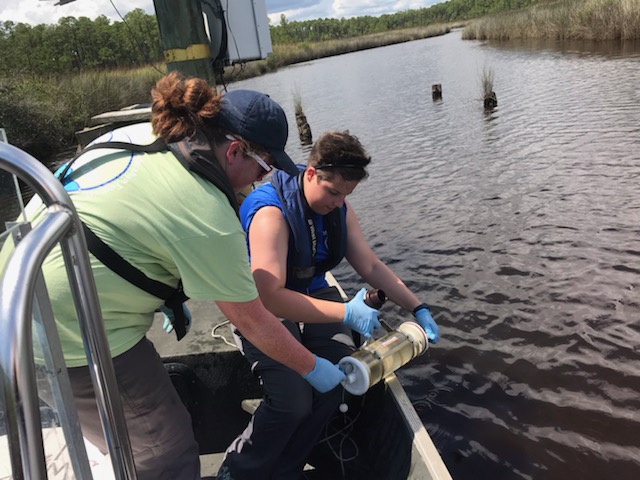
Plankton are essential to aquatic ecosystems but can cause concern when at abnormal concentrations. Because of its close proximity to industrial activity, the Grand Bay National Estuarine Research Reserve (GNDNERR) has previously experienced drastic water quality changes, elevated nutrient levels, and algal bloom events. Therefore, it is important to provide insight into typical plankton community structure, seasonality, and spatial differences to identify instances of unusual plankton concentrations. From July 2023, monthly surface-water samples and water quality data were collected at fifteen sites across the reserve. Microscopy was used for observation, identification, and Sedgewick-Rafter enumeration. Through these methods, recurrent information on plankton community structure was gathered. Combined with water quality and nutrient monitoring, the ongoing collection of this reference data will aid in detecting considerable shifts in concentrations, why they may have occurred, and what ecological and economic impacts these changes may bring to GNDNERR.
Jonathan Pitchford, Grand Bay NERR
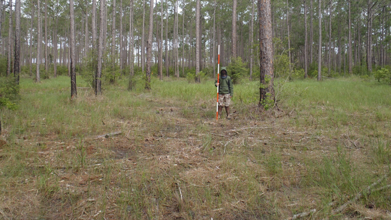
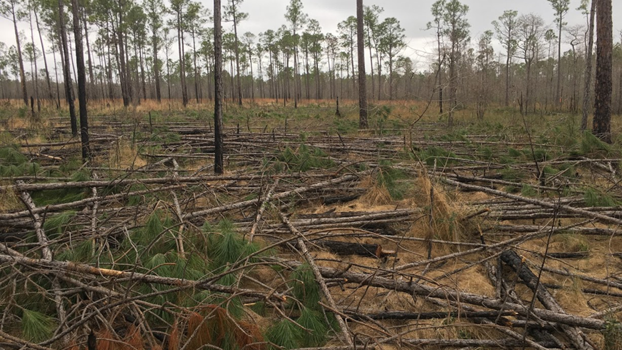
Pine savanna and flatwoods habitat restoration along the Gulf coast is complex and rife with challenges. These habitats have been fire suppressed for decades resulting in heavy fuel loads and are often adjacent to the Wildlife Urban Interface (WUI). Invasive species are often prolific and take persistent treatments to control or eliminate. Also, the weather along the Gulf Coast is varied and unpredictable and can be a huge obstacle for implementing restoration treatments. As such, there is a great need to engage with experienced practitioners as we develop restoration plans and to use creativity and innovation to overcome the many challenges that are impediments to savanna and flatwoods restoration. I am interested in forming a small group (5-10 people) that are willing to participate in an Upland Habitat Restoration Management Application Team (UHR-MAT) that can lend experience and insight to restoration efforts along the Gulf coast. I am also hoping that this group can foster development of innovative solutions to some of the common problems we are facing that are described above. To do so will require the investment of time and energy, so one of the things I want to do is to be creative in how I engage with this group to maximize their collective knowledge, but minimize the pester factor I am hoping to get ideas from anyone who is reading this abstract/poster on 1) innovative tools for upland habitat restoration, 2) members that should be included in the UHR-MAT, and 3) creative ways for the group to interact that aren’t too burdensome on the members. The more ideas, the better!
Favour Onyido, Emma Schopen, Jose Febles Diaz, Haomin Huang, and Zhaofei Fan.
Biomass estimation is an essential part of being able to measure carbon sequestration. However, biomass estimation is traditionally done through stem analysis, which involves the physical weighing of the trees, which is labor and cost-intensive. Because of this, scientists are trying to find more efficient ways to estimate biomass. In this project, we are felling trees in the Grand Bay Coastal Resources Center to measure different tree parameters such as height, canopy cover, and diameter at breast height (DBH) to create allometric relationships to estimate biomass as well as be able to compare it to the true biomass value. We are also focusing on more nondestructive sampling methods, such as using increment cores to calculate wood density values using Near Infrared Spectrometry (NIR) to be used in volume conversion captured by a terrestrial lidar scanner.
Using field data, we first established a general biomass allometric equation. However, the equation uses a DBH variable which limits it to field-acquired measurements. Following this, we established a relationship between biomass and height, and this relationship presents an opportunity to use LIDAR-acquired height measurements to estimate biomass. The estimated biomass can be converted to carbon sequestration using species-appropriate biomass-to-carbon conversion factors.
Results from this project would include systematic methodologies for estimating biomass through filed and Lidar-acquired measurements and wood density measurements. Resource managers can utilize these methodologies to accurately estimate their forest lands’ biomass content or carbon sequestration levels.
Eric Sparks, Sara Martin, Jaden Akers, Ashleigh Dunaway
Natural shorelines provide ecosystem services that are integral to maintaining healthy and resilient coastal ecosystems and communities. However, anthropogenic and environmental stressors are reducing the extent of natural shorelines and, thus, their capacity to provide critical ecosystem services. Small-scale private property owners own an overwhelming majority of waterfront property in coastal Mississippi and Alabama. Therefore, environmentally-focused management of private shorelines can provide large-scale benefits. Unfortunately, the most common shoreline management strategies for private property owners are hardened structures (e.g., bulkheads and seawalls) that are known to impair coastal ecosystems. An alternative to hardened shorelines is living shorelines, which are a collection of shoreline stabilization techniques that incorporate natural materials such as native shoreline plants. To promote living shorelines with private property owners, the Mississippi-Alabama Sea Grant Living Shorelines Program and its partners began producing guidance documents, offering technical assistance, developing cost-share programs, and conducting trainings for private property owners and contractors. In this presentation, we will discuss the status of the technical assistance programs and needs related to enhancing these programs across both states.
Eric BruBaker, Zhaofei (Joseph) Fan, Heather Alexander, and Christopher Anderson
College of Forestry, Wildlife and Environment, Auburn, Alabama 36849
Martin Spetich, USDA Forest Service Southern Research Station, Hot Springs, AR 71902
Endangered coastal pine flatwoods and savannas found in the southeastern US consisting of an overstory of longleaf and slash pine (Pinus palustris, P. elliottii) are at risk of invasion from Chinese tallow (Triadica sebifera). This study aimed to determine what environmental factors along the Gulf of Mexico coast influence post-topkill mortality and resprouting vigor (aggregate resprout length) in those survived trees. A group of tallow trees of varying size and age classes were collected at two study sites: Grand Bay National Estuarine Research Reserve (NERR), approximately 2 km off the Gulf of Mexico coast, and Mississippi Sandhill Crane National Wildlife Refuge (NWR) 9 km from the coast to assess what drives tallow tree mortality and resprout vigor.
Over one year, we found that initial resprouting vigor in tallow trees is driven by canopy closure and tree size, with larger trees under open canopies resprout with the greatest aggregate length. Mortality, however, is impacted by soil EC, with trees growing at the low EC site being ~ five times more likely to survive than those at the high EC site. In addition to top-killing mature trees, we collected a sample of 2-4-year-old seedlings from both study sites to assess differences in belowground nonstructural carbohydrate stores that could potentially influence mortality and resprouting vigor following top kill. Total nonstructural carbohydrates (tNSC, %) were similar between both sites; starch was higher at the low EC site, while sugar was higher at the high EC site nearer the coast. Additionally, seedlings growing closer to the coast in high soil EC had shorter roots but greater root biomass, suggesting a limited rooting zone and nutrient-poor growing conditions that could adversely affect survival. While the scope of these findings is limited to two study sites in southern Mississippi, US, the apparent impact of soil EC on tallow seedling tNSC and mature tree mortality suggests that it could limit the invisibility of at-risk ecosystems nearer the coast with higher soil EC. Similarly, managing and removing invasive tallows, specifically with prescribed fire, from high EC sights could be more effective in controlling the species by preventing resprouts after top kill.
Jaden Akers, Nigel Temple, Eric Sparks
Eastern oysters are well known ecosystem engineers responsible for water filtration, providing habitat and refuge for numerous species, and other ecosystem services. However, natural oyster reefs are declining due to several natural and anthropogenic threats. To mitigate for the loss of natural oyster reefs, many reef restoration projects have been completed and several more are being planned. It is known that variation in reef height, interstitial space, and slope can encourage oyster settlement, but little is known about how reefs can be designed to exclude predation of oysters by oyster drills, fish, crabs, and other predators. In this study, we seek to quantify the effectiveness of varying oyster reef designs at excluding predation. Sixteen replicates each of eight different reef designs varying in height, slope, and vertical spacing have been created from Portland cement and seeded with oysters from Auburn Shellfish Lab. These reefs have been deployed in Bayou La Batre, AL in a block design with two replicates of each reef design deployed in a single block. Monthly photographs to determine oyster growth and survival in addition to predator counts will be collected and analyzed. After 8 months, 50% of the reef units were removed from the field and placed in a mesocosm with 8 separate blocks (1 replicate each). Daily monitoring captured the location of oyster drills on each reef unit. Results from this study can be used to inform the design of oyster reef restoration projects.
Attendees & Research Interests
- Aaron Bland: Living Shorelines, Oysters, Macroinfauna
- Alex Rodriguez: Marine Ecology, Wetland Conservation, Restoration, Restoration Monitoring Results and Techniques, Innovative Technology
- Amanda Free: environmental microbiology, water quality, soils
- Ansley Levine: Coastal ecology/restoration
- Anthony Vedral: Marine Debris, Microplastics, Wetlands, Coastal Ecology, Habitat Restoration
- Bailey Richardson
- Binnaz Bailey: safety in research
- Cadie Barnes: Biogeochemical cycling in wetland ecosystems, greenhouse gas dynamics, ecosystem interactions, coastal restoration
- Cameron Donofrio: Biogeochemistry, Biology, Ecology
- Cassy Porter: All of it
- Chaz Newman: Longleaf pine savanna restoration
- Conner Eubanks: fish populations
- Daley Koenig: Wildlife Biology/ecology, marine biology, animal husbandry, conservation, chondrichthyans
- Dennis McGrury: Stormwater management with NBS
- Emmett Carstens: Plants and animals of pine savannas
- Eric Sparks: Living shorelines, marine debris, coastal ecology
- Graham Good: Forest Ecology, ecosystem ecology, science communication, outdoor education
- Iwo Gross: Conservation implications of terrapin mating system dynamics
- Havalend Steinmuller: coastal biogeochemstry
- Jackie Sablan: Living shoreline use and wildlife management techniques
- Jacob Goff: Longleaf Pine Savanna Habitat Restoration
- Jake Pettigrew: Coastal habitat management
- Janet Wright: biodiversity, restoration, climate change
- Jason Saucier: fisheries management
- Jay McIlwain
- Jeneil Patel: Plankton, water quality, oceanography
- Jennifer DeBose: Coastal ecology, chemical ecology, living shorelines, bioindicators, animal behavior
- Jennifer Cumbest: NERR Science 🙂
- Jeremy Edwardson: Land management
- Jessica Woodall: nekton habitat use, seagrass ecology, conservation
- John Conner: Ecology, soil science, biology
- Jonathan Pitchford: habitat restoration
- Katie Loesser: coastal ecology, restoration, food web ecology
- Mark Woodrey
- Nicholas Stewart: fisheries
- Kelly Darnell: Coastal ecology; seagrass biology and ecology
- Kelsey Hofheinz: Behavioral and physical adaptations by local fish communities, habitat preference research
- Larisa Lee: modeling, stakeholder engagement, coastal ecology
- Laura Blackmon: STEM and Marine Science Education
- Laura Moncrief: upland habitats
- Luke McDonald: environmental science (aquatic ecosystems)
- Maggie Waldron: Coastal biogeography, coastal elevation dynamics, resilience of coastal habitats to SLR
- Makenzie Holifield: stormwater flooding/green infrastructure in a marginalized coastal community and remote sensing predictive modeling on aboveground biomass in NGOM marshes.
- Mandy (Sartain) Rigsby: bat ecology; wildlife ecology
- Margo Posten
- Matheus de Barros: Bayesian statistics, modeling, fisheries
- Maya Stratman: Conservation Grazing
- Megan Chevis: Wetlands ecology and restoration, biodiversity
- Meg Custard: conservation and environmental consulting
- Michael Andres: Fisheries Ecology, Telemetry, Habitat Restoration, Gulf Sturgeon, Parasitology
- Michael Archer: wetlands, fish
- Morgan Lane: Wildlife Biology, ecology, conservation
- Nathan McGregor
- Nick Folse: conservation
- Olivia Pickett: invasive species
- Patrick Biber: seagrass, Saltmarsh
- Paula O’Briant: Wildlife Conservation
- Penny Demetriades: microbial source tracking, eDNA, molecular biology
- Robert Griffitt: ecotoxicology, toxicogenomics
- Ronald Baker: estuarine ecology
- Ruth Carmichael: Bioindicators of human influence, wastewater, shellfish, marine mammals, stable isotopes, metals
- Sandra Bilbo: visitor studies, education, plankton, geology, and all things GNDNERR
- Sara Martin: Wetlands, living shorelines, restoration
- Shannan Mcaskill: fish early life history and seagrass
- James (Skip) Rigney: phenology, coastal oceanography including sea level changes
Virtual Participation
Use the link for Microsoft Teams to join virtually. We will have all the presentations webinar style, so cameras and microphones are disabled. If you have any questions, please use the chat box. We will have an opportunity to interact with virtual guests during the facilitated discussion at 3:45 pm Central.