
It’s definitely hot out there! Though we started out the month with a low of 69 F (20.5 C), we ended the month with a low of 76 F (24.4 C), and a high of 90 F (32.2 C), and a monthly high of 95% relative humidity! Water temperature peaked at 94 F (34.5 C) on June 21.
We’ve seen some beautiful storm clouds out over the bayous and it’s been a bit troublesome planning our field work between and around the storms!
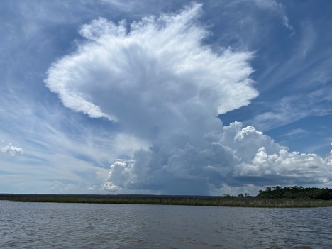
Figure 1. Thundercloud over Grand Bay NERR (photo by J. Patel).
This month we’ve had some visiting undergraduate scholars (NOAA Hollings Scholars) that have been working on some of our priority research questions:
Jessica Yesensky is working with our Stewardship Coordinator (Jonathan Pitchford) and is digging deep into our marsh elevation data and working to help us understand the benefits and limitations of ground versus uncrewed aerial systems for collecting marsh surface elevation. Tracking marsh surface elevation is important because it helps us figure out how the marsh is faring – is it sinking or increasing in elevation? And this helps with modeling flood risk as well as understanding other marsh community dynamics.
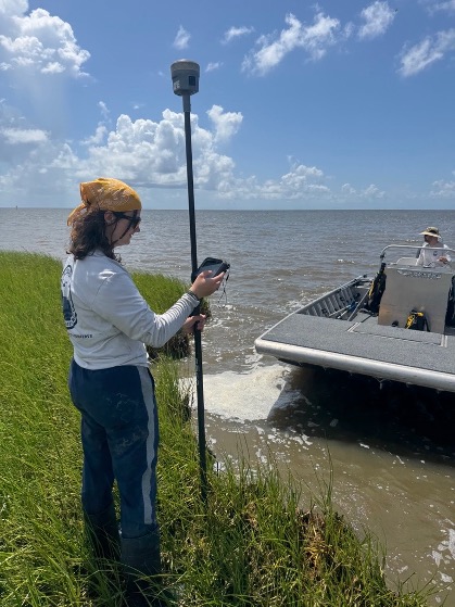
Figure 2. Jessica conducting shoreline erosion monitoring using RTK (Real Time Kinematic Positioning) (photo by J. Pitchford).
Justin Osborne is working with our Research Coordinator (Jennifer DeBose) and Jeneil Patel (Margaret A. Davidson Fellow), looking at phytoplankton community shifts over seven weeks. He’s taking weekly samples and coupling that with water quality measurements (including SWMP station data) and MET station precipitation data to see if there are correlations between different environmental parameters and community composition. We’ve never done weekly phytoplankton sampling so it’s fun to see how these communities are shifting over short time scales and when and where we’re seeing more plankton abundance. Plankton equals food for fish, so this data will help us shed light on which bayous are more productive than others and why. Though I’m sure the fisher-people out there have lots of insight on where they find the fish!
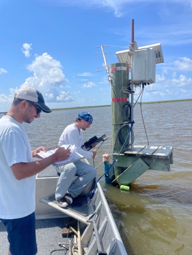
Figure 3. Jeneil and Justin take water quality measurements at one of the plankton collection sites (Photo by E. Moore).
Coen McGarrah has been trapping and counting oyster drills in Bangs Lake, Bangs Bayou and Point aux Chenes. So, if you see our white buoys in a line – those are the oyster drill traps! We’ve found soooo many drills! We’re surveying the area and linking their numbers to environmental conditions (water quality, depth, distance to shore, and sediment type). So, we’re also collecting sediment cores to determine the sediment composition at each site. And back at the office, Coen will be running experimental trials with the captured drills – to determine their sediment preferences to help us figure out where drills prefer to be in our estuary. This might help us locate good oyster reef restoration locations in the future – both locally and farther afield.

Figure 4. Coen drops an oyster drill trap back into the water (Photo by J. DeBose).
So, although normally our summers tend to be more relaxed since a lot of our fieldwork is on hiatus (except for SWMP – that’s ALWAYS going on!), this summer has been busy with lots of field research and activity!